
Description
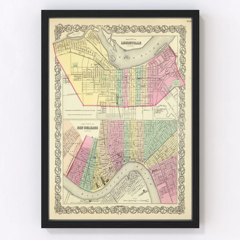
Discover a piece of Louisville’s storied past with this beautifully restored vintage map, originally crafted in 1856. Featuring Jefferson County and nestled within the heart of Kentucky, this historical gem offers a unique view of the city as it once was. Whether you’re a local history enthusiast or just someone who appreciates timeless decor, this map is a perfect choice.
Our digital restoration process ensures that every detail is crisp and clear, breathing new life into this antique document. Each print arrives ready to hang and has been meticulously constructed by hand. Choose from framed options with elegantly stained solid wood or opt for an unframed print on high-quality matte paper. Our canvas prints are carefully created using polycotton material stretched over solid wood bars.
This Louisville map adds sophistication to any room, making it ideal for both home and office settings. It’s not just decoration; it’s an engaging conversation starter that celebrates local heritage in style!

Reviews
There are no reviews yet.