
Description
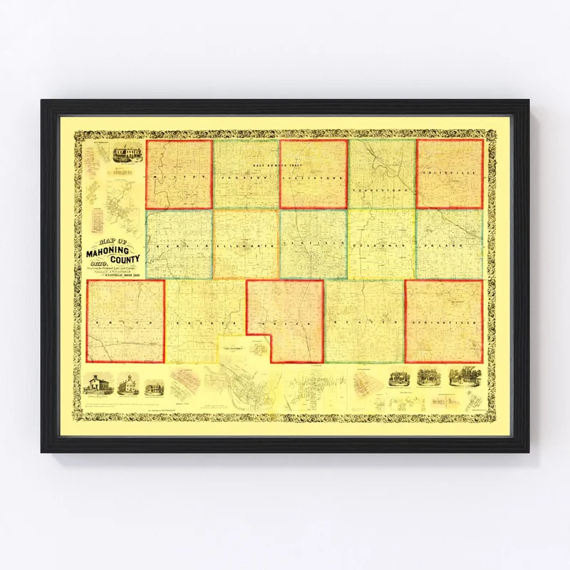
Discover a piece of history with our meticulously restored 1860 vintage map of Mahoning County, Ohio. Crafted with high-quality materials, this map is an ideal gift for local history enthusiasts or those with a curiosity about the past. Perfectly suited for any home or office setting, it adds a touch of class and tradition to your decor.
Featuring notable towns like Youngstown, Boardman, and Canfield from Mahoning County’s rich past, this map not only serves as an eye-catching focal point but also as a delightful conversation starter that celebrates local lore. Our prints arrive ready to hang right out the box, constructed by hand with solid wood frames that are beautifully stained for durability.
If you prefer unframed prints, rest assured they are printed on high-quality matte paper. For those who choose canvas prints, you’ll love the polycotton canvas stretched over solid wood bars – all hand assembled for a refined finish. Explore the charm of 19th-century Ohio and see how this distinct slice of America once was.
Reviews
There are no reviews yet.