
Description
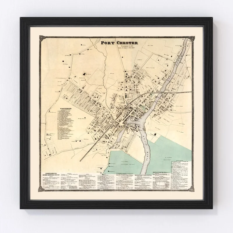
Rediscover the charm of the past with our beautifully restored 1867 map of Port Chester, nestled in Westchester County, New York. This unique print brings local history to life and is perfect for anyone with an interest in historical maps and vintage style. Whether it’s displayed at home or in your office, this timeless piece offers a touch of traditional class.
A conversation starter by design, each map print is handcrafted to ensure exceptional quality. If you’re looking for the perfect gift idea for a history enthusiast or someone who loves unique decor, this map won’t disappoint. Our prints are ready to hang straight out of the box; framed versions feature solid wood stained frames that lend warmth and authenticity to any space.
The canvas prints are expertly crafted using polycotton canvas mounted on solid wood stretcher bars. For those who prefer unframed options, we use high-quality matte paper that highlights every detail of this exquisite vintage reproduction. Add a piece of Port Chester’s storied past to your surroundings today!
Reviews
There are no reviews yet.