
Description
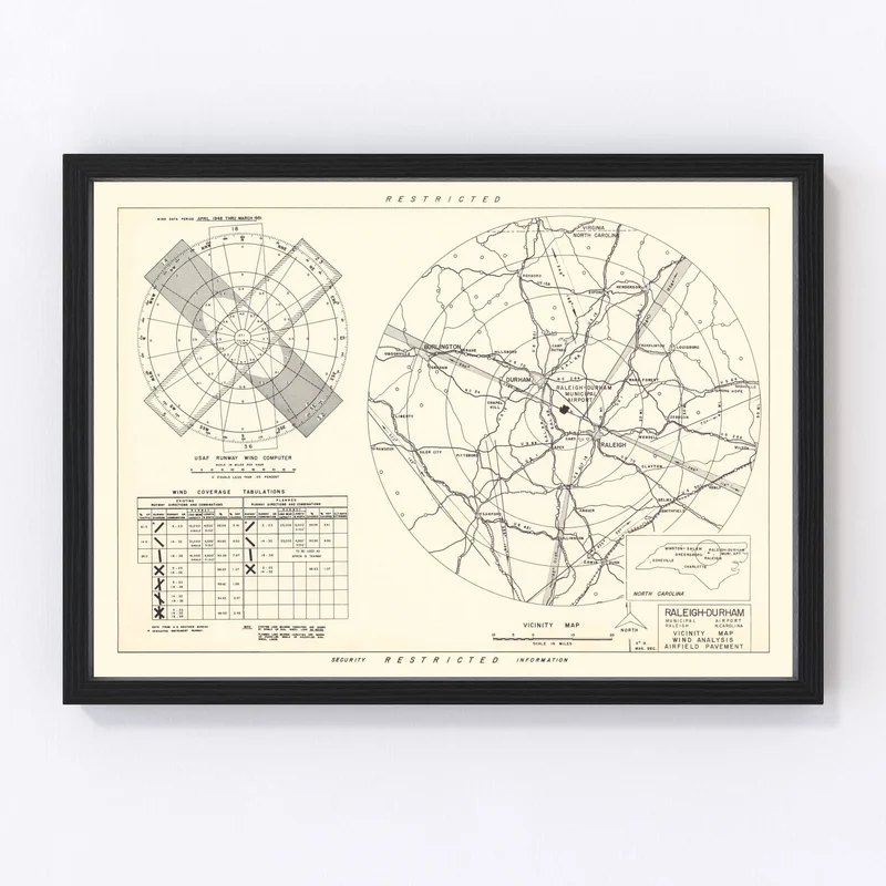
Discover a piece of history with our restored 1952 vintage map of Raleigh, nestled in Wake County, North Carolina. Perfect for admirers of local heritage, this meticulously crafted map makes an ideal gift and an intriguing addition to any home or office setting.
The timeless charm of this map invites conversations about the rich past of Raleigh while adding a touch of sophistication to your space. Our prints are crafted to an exceptional standard, ensuring that you receive a product that is as durable as it is visually appealing.
Ready to grace your wall right out of the box, each framed print is beautifully encased in handcrafted solid wood. For those who prefer canvas prints, enjoy the blend of polycotton canvas elegantly stretched over robust solid wood stretcher bars. We also offer unframed options on premium matte paper for a more versatile display.
This map isn’t just wall art; it’s a slice of history brought back to life and ready to inspire stories and memories around it.
Reviews
There are no reviews yet.