
Description
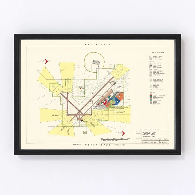
Explore a piece of history with our beautifully restored 1951 vintage map of Youngstown, located in Mahoning County, Ohio. This unique piece showcases the charm and history of the area and is an ideal gift for anyone who appreciates local culture and heritage. Crafted with care, each map is made using high-quality materials that promise durability and a polished finish.
Our prints are ready to hang as soon as they arrive at your door. Whether you choose the handcrafted framed version or prefer the high-quality matte paper option for flexibility in framing yourself, this map is a timeless addition to any decor style. The wooden frames are crafted from solid wood that has been meticulously stained, offering a touch of tradition.
This charming historical artifact serves not just as wall decor but also as an engaging conversation starter. Share stories about Youngstown’s past with friends or family while enjoying its intricate details on your wall at home or in your office.
Reviews
There are no reviews yet.